Use Case Examples
Government Scenarios that benefit from the Velosimo Connector
ESRI ArcGIS Survey123 is a highly configurable forms tool that Agencies can customize for many needs. And Cartegraph, while specific to Asset Management, is also very configurable to be tailored specifically to an Agency's asset collection and way of business. As a result, there is an endless array of scenarios for government when these two products are intelligently integrated with the Velosimo Connector.
The Velosimo Connector supports Survey123 forms to submit asset tasks (activities), update asset properties, and submit service requests in Cartegraph.
Asset Tasks
Asset tasks in Cartegraph are common activities executed against physical assets, such as installation, repair, replacement, cleaning, etc.
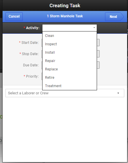
In this example, we are going to set up a cleaning scenario:
The agency has outsourced specific asset management field tasks to an outside contractor and wants to track the activity and results automatically in Cartegraph. Also, they want to provide an easy way for the contractor to enter related information using their existing ArcGIS Survey 123 service.
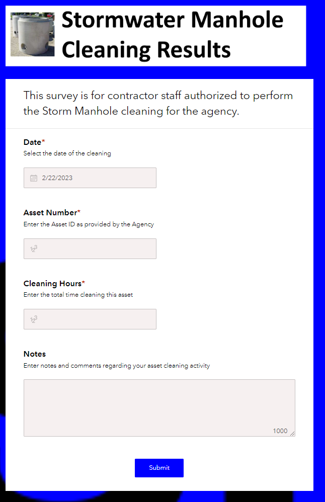
With the Velosimo Cartegraph – ArcGIS Survey 123 connector, the contractor’s ArcGIS Survey 123 form submissions are automatically transferred to assets and activities within Cartegraph. The agency has provided the contractor with a list of Stormwater Manhole Assets, including IDs, for cleaning. It has provided the contractor with an ArcGIS Survey, which the contractor completes for each visit. The Agency will see the contractor’s activity and results in Cartegraph as they occur, associated with the appropriate assets. The contractor will have a purpose-built survey form with the following fields: date, asset number, cleaning hours, and notes.
ArcGIS Survey123 Form
The following form is set up in Survey123 to capture the needed data from the Contractor. It is securely shared only with contractor field staff so they can submit their activity results quickly and easily using any device:
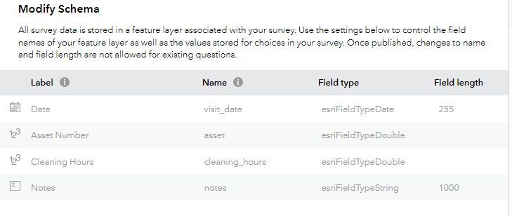
Also, here you can see the ArcGIS Survey123 Schema mappings.
Note: it's the 'name' (not Label) that is USD when mapping the survey when setting up the connector.
Velosimo Connector
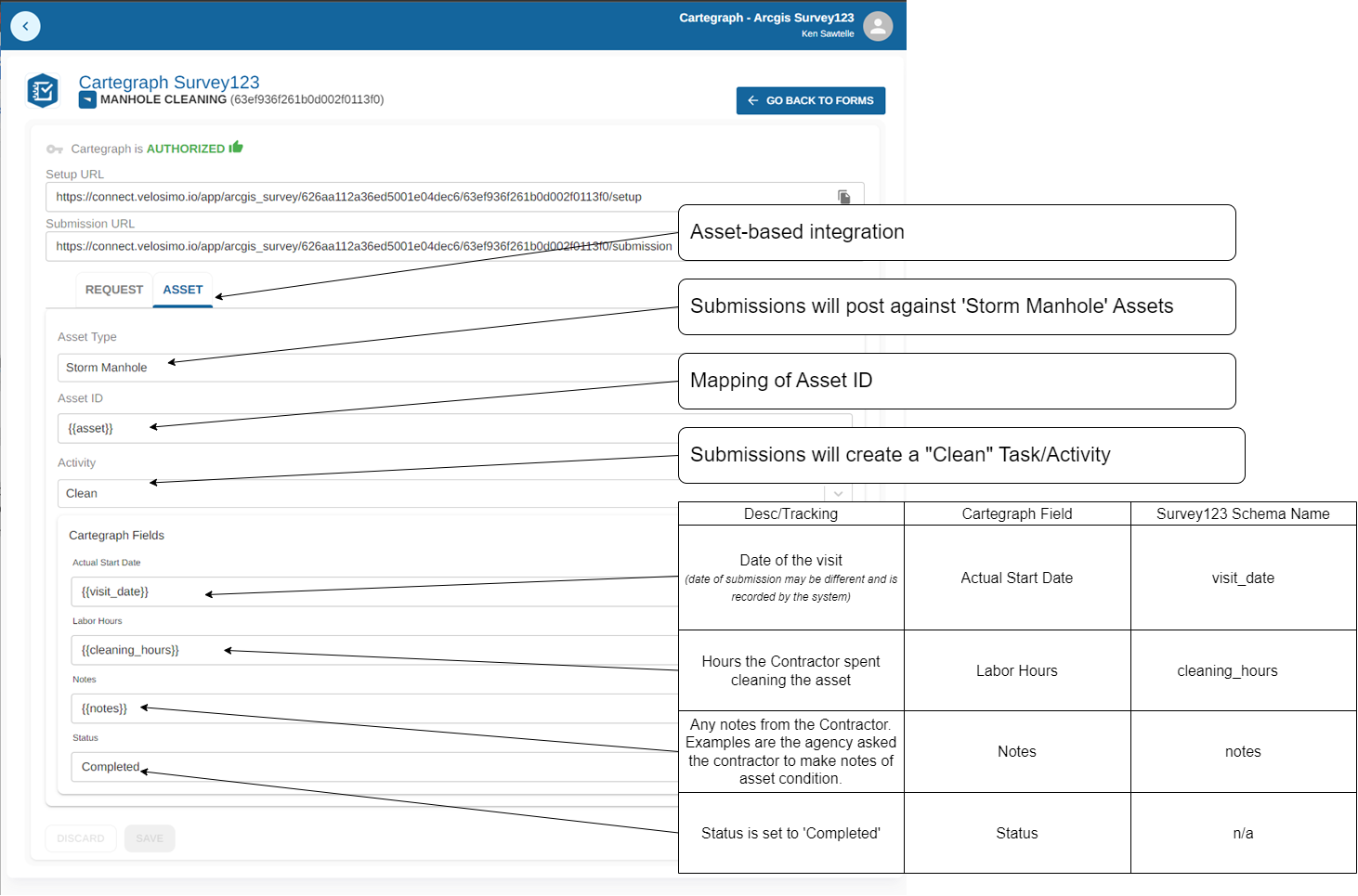
The following is the mapping setup for the Velosimo Connector form configuration.
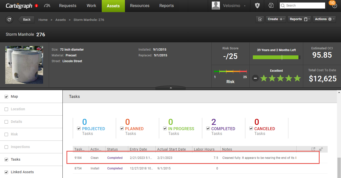
Cartegrah Results
Here you can see the results of contractor field activity by use of the Survey123 form and the Velosimo Connector:
Updated 3 months ago
